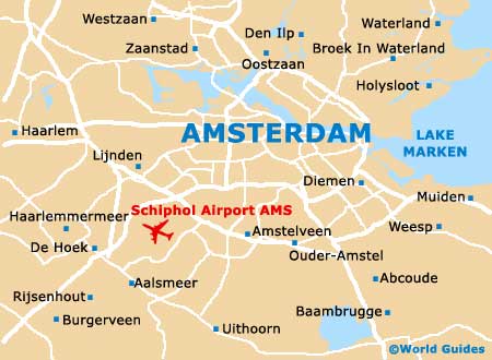
Amsterdam Schiphol Airport (AMS)
City Orientation and Maps
(Amsterdam, Netherlands)
Famous throughout the world for its canals, cafes and Red Light district, the city of Amsterdam was once a small fishing town. Now one of the most visited locations in the whole of Europe, Amsterdam enjoys its popularity and tourists are always welcomed.
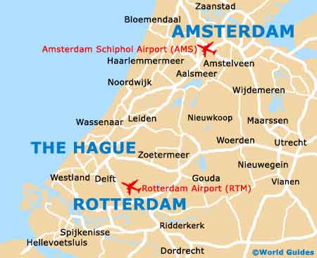
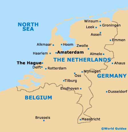
Amsterdam lies on the western coast of the Netherlands, in the 'Noord-Holland' area. Prominent cities within driving distance of Amsterdam include Rotterdam to the south, which can be reached in around one hour. Also nearby are Velsen and Zaanstad to the north-west, Haarlemmermeer to the south-west - close to Amsterdam Schiphol Airport (AMS), and Purmerend to the north.
Amsterdam Schiphol Airport (AMS) Maps: Important City Districts
The very heart of Amsterdam can be found to the south of the JJ River and close to the enormous Ijsselmeer Lake. Much of the historic old town area of Amsterdam is based around a series of concentric canals, known locally in Holland as 'grachten'. Many visitors to the city enjoy canal cruises, which is always a good way to get acquainted with Amsterdam and its many attractions.
The Centraal Station is situated in the centre and is a particularly grand building, close to many restaurants and bars, with the colourful Red Light district just a short walk away.
Amsterdam features two large universities and around 40,000 students in total, with the Universiteit van Amsterdam (UvA) being home to approximately two-thirds of these students. With no actual campuses, the university colleges are dotted throughout the city and include a number of historic buildings.
Netherlands Map
Amsterdam Map